UPDATE: FRIDAY, AUGUST 21, 10:20 AM ... Smoke inversions lifted across much of the area yesterday resulting in an increase in fire activity but no loss of containment. Weather over the weekend may help firefighters as temperatures are expected to drop, humidity increase, and winds staying relatively moderate in the valleys but potentially gusty at higher elevations.
Containment has plateaued at the River Complex and fire entered the northern parts of the town of Denny yesterday . A burnout buffer zone held and no structural damage was reported.
DENNY (River Complex)
Acres = 50,424
Containment = 22%
Personnel = 667
New Voluntary Evacuation Warning
Effective 3 PM, Friday August 21:
Due to increase fire activity in the southeastern portion of the River Complex, the Trinity County Sheriff's Department has issued a voluntary evacuation order for residents in the following areas:
- FOREST ROAD 5NO4 (Prairie Creek Road)
- FOREST ROAD 54013 (French Creek Road)
- FOREST ROAD 5N04 (Big Mountain Road)
Fire began to burn in the northern parts of Denny but burnout buffer zones prevented any structural damage.
The fires have merged within the complex. The inversion lifted yesterday and helicopters were deployed for the first time in four days.
Containment held from Lone Pine Ridge to Bell Flat offering protection to residents along Highway 299 to Willow Creek, and from Willow Creek to Hoopa Tribal Land.
Information on evacuations, road closures, and support services HERE.
Air Quality information HERE.
~*~*~*~*~*~*~*~*~*~*~*~*~*~*~*~*~*~*~*

Acres = 23,565
Containment = 50%
Personnel = 1,031
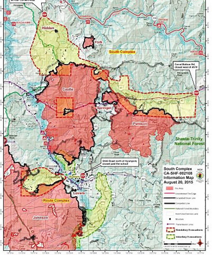
The smoke inversion lifted around 5 PM yesterday and the fire became more active. Most of the activity was on the northwest side of the Pattison Fire, just north of Forest Road 3N05.
There was also increased activity on the Castle Fire. Clearing allowed aircraft monitoring which showed no major areas of concern.
Information on evacuations, road closures, and support services HERE.
Air Quality information HERE.
~*~*~*~*~*~*~*~*~*~*~*~*~*~*~*~*~*~*~*
HAYFORK (Fork Complex)

Acres = 36,473
Containment = 68%
Personnel = 2,150
There were major gains in containment since yesterday as the weather moderated.
Suppression repair activities have begun on the Barker and Blue fires and containment lines are being held in the Wildwood area.
Some crews are timing out and some reassigned to other parts of the country.
Information on evacuations, road closures, and support services HERE.
Air Quality information HERE.
~*~*~*~*~*~*~*~*~*~*~*~*~*~*~*~*~*~*~*

Acres = 34,543
Containment = 35%
Personnel = 920
Gobbler Fire is 100 percent contained. Pickett fire is at 78 percent containment.
The Johnson Fire (29 percent containment) is at mop up status on the north flank. The southern and western perimeter are now in burnout stage.
Information on evacuations, road closures, and support services HERE.
~*~*~*~*~*~*~*~*~*~*~*~*~*~*~*~*~*~*~*
RUTH LAKE (Mad River Complex)

Acres = 31,190
Containment = 65%
Personnel = 1,023
The Lassic Fire continues to spread to the southeast. Structural defense is in place for the Rutledge area.
There will be a public meeting TODAY, 5:30 PM, at the Lamb Creek Christian Center on Highway 36 in Mad River.
Information on evacuations, road closures, and support services HERE.
Air Quality information HERE.
~*~*~*~*~*~*~*~*~*~*~*~*~*~*~*~*~*~*~*~*~*~*~*~*~*~*~*~*~*~*~*~*~*~*~*~*
THURSDAY, AUGUST 20, 10:20 AM ... After three days of scorching heat and low humidity, the high pressure system which has dominated the area is weakening. Forecasters expect highs to stay below 90 degrees throughout the weekend. Humidity will increase, but winds will likely increase and potentially boost fire activity.
Three out of five fire complexes have containment over 50 percent (South, Fork, Mad River).
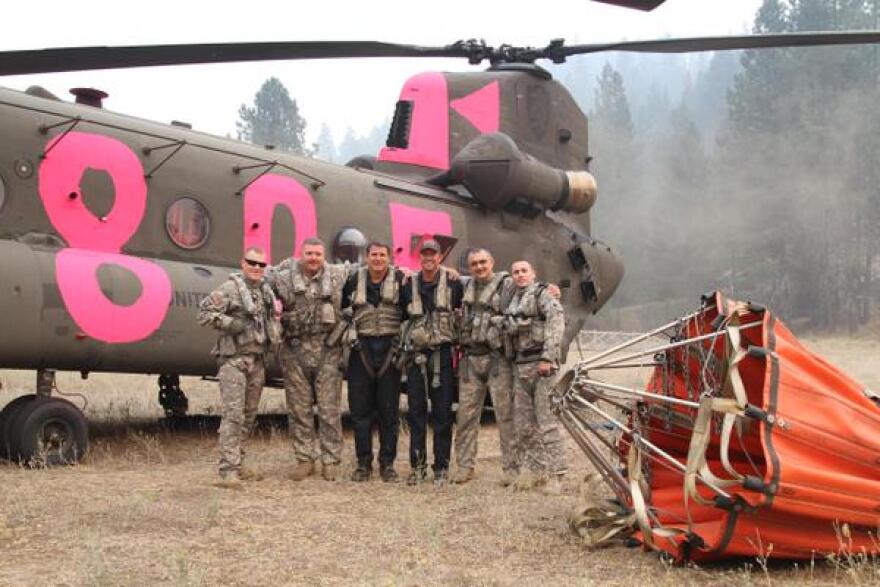
Over 170,000 acres have burned. Current personnel deployment is nearly 6,000. This includes National Guard troops that are expected to remain in the area through Sunday.
DENNY(River Complex)
Acres = 48,099
Containment = 22%
Personnel = 675
The fire continues to back down toward the northern end of the town of Denny and firefighters are beginning to implement structural defense. A dozer line is also being created along the southeastern flank to keep the Highway 299 corridor open.
Information on evacuations, road closures, and support services HERE.
Air Quality information HERE.
~*~*~*~*~*~*~*~*~*~*~*~*~*~*~*~*~*~*~*

Acres = 22,767
Containment = 50%
Personnel = 1,062
A PUBLIC MEETING will be held TODAY, 4 PM, at the Hyampom Volunteer Fire Department.
A persistent smoke inversion moderated fire activity yesterday but the Patterson Fire remained active, particularly along the western flank. Dozers are constructing a line to protect the Bar 717 structures.
Information on evacuations, road closures, and support services HERE.
Air Quality information HERE.
~*~*~*~*~*~*~*~*~*~*~*~*~*~*~*~*~*~*~*
HAYFORK (Fork Complex)

Acres = 36,285
Containment = 60%
Personnel = 2,002
The Barker, Blue, and Peak fires remained relatively quiet yesterday and containment lines were strengthened along the southern perimeter of the Shiell Fire.
Weather today is expected to be cooler with light winds and a slight increase in humidity.
Approximately 200 National Guard troops will remain at the Fork Complex through Sunday.
Information on evacuations, road closures, and support services HERE.
Air Quality information HERE.
~*~*~*~*~*~*~*~*~*~*~*~*~*~*~*~*~*~*~*

Acres = 34,350
Containment = 37%
Personnel = 920
The Mad River and Route Complexes have merged resources for management purposes.
Humidity is expected to recover (increase) at lower elevations today but drier conditions and gusty winds will likely dominate at higher elevations. This may lead to both uphill and downhill fire runs.
Significant progress has been made with the Johnson Fire. Burnout operations have been successful on the northern flank and will continue along the more active western perimeter.
Information on evacuations, road closures, and support services HERE.
Air Quality information HERE.
~*~*~*~*~*~*~*~*~*~*~*~*~*~*~*~*~*~*~*
RUTH LAKE (Mad River Complex)

Acres = 30,084
Containment = 65%
Personnel = 1,064
A PUBLIC MEETING will be held FRIDAY, AUGUST 21 at 5:30 PM at the Lamb Creek Christian Center (Highway 36 in Mad River).
The Lassic Fire remains the most active fire and continues to back down the western perimeter. Structure defenses are in place for the Rutledge Area.
Information on evacuations, road closures, and support services HERE.
Air Quality information HERE.


